Monday, 17 September 2018

The Irupu Falls...Brahmagiri Range Kodagu district of Karnataka


The Irupu Falls  are located in the Brahmagiri Range in the Kodagu district of Karnataka, India, bordering the Wayanad district of Kerala.
 It is a fresh water cascade and is situated at a distance of 48 km from Virajpet on the highway to Nagarhole. 


A picturesque waterfalls cascading along the Brahmagiri Mountain Range, Iruppu falls is one of the most beautiful tourist attractions in the Coorg district of South Karnataka. These are also known as the Lakshmana Tirtha Falls, a name derived from the tributary of Cauvery River 

 Among them Iruppu is the most popular, not just for its mesmerizing beauty and greenery, but also because of its religious importance. People come here to enjoy the blissful vicinity of nature, the grandeur of the falls and for seeking spiritual peace in the tranquillity of the place.

route to the magnificent falls stands the famous Shiva temple Rameshwara along the banks of the river. Both the river stream and the temple have folklore behind their existences which have roots in the story of the epic Ramayana.

 The pristine cold water of the Iruppu falls is considered to be holy and possessing powers to clean the past sins of the visiting devotees.

 A major tourist attraction, the falls attracts a large number of tourists every year, especially during the festival of Navaratri. Located on a lush, green mountain slope, a forest trail leads from these falls to the Brahmagiri Peak.


The best time to visit the falls is during the monsoons when they are at their full capacity and hence become a breathtaking sight to behold.

Iruppua Falls Timings and Entry Fees

The visitors are charged INR 50 per head for entry.

The Iruppu Falls is open from 6:00 AM - 6:00 PM every day of the week.

Address: Kurchi, Karnataka 571250
Height: 52 m
Phone: 097433 07137
>>----THANKS FOR VISITING MY BLOG...KEEP IN TOUCH------>

Sunday, 16 September 2018

Panchalimedu is a hill station Idukki TOURISUM


Panchalimedu is a hill station and view point near Kuttikkanam in Peerumedu tehsil of Idukki district in the Indian state of Kerala. A number of hills make up the landscape of Panchalimedu.

 On the Makar Sankranti day, lots of Ayyappa devotees camps there to witness the sacred Makaravilakku (holy flame) that appears in the Ponnambalamedu near Sabarimala temple.

Predominantly it is a high altitude region situated at a height of 2,500 ft (760 m) above the  sea level.

The place is surrounded by deep valleys and hills, accompanied by meadows, grasslands and cool refreshing climatePanchalimedu is located on the route to Kanayankavayal in the Azhutha block of Peerumedu tehsil

According to legend, the Pandavas along with their wife Panchali, were said to have resided in this region during the course of their exile from their kingdom from the great epic The Mahabharata  . Hence the place got its name Panchalimedu which derived from the words "Panchali"  and "medu" (hill).

Here, a cave is known as bearing the footprints of Bhima. There is small temple dedicated to Bhuvaneshwari. The remnants of Shivalingas, thrishul, naga idols are also there.
A small pond is there, which is known as ‘Panjali Kulam’, in which Panchali (wife of Pandavas) used to take her bath.

Distances:
  • 2 Kms from Kuttikkanam (When you come from Kumily, Thekkady)
  • 8 Kms from Peruvanthanam (When you come from Kottayam)
Getting There:
By Road:
7km hike from Murinjapuzha on Kottayam Kumily route. (Jeeps are available from Murinjapuzha)
8 Kms from Peruvanthanam (Jeeps or autos available from Peruvanthanam)

ACCOMMODATION
Kuttikkanam, Peerumedu or Mundakkayam

Best Season to Visit:
Throughout the year, except during monsoon.
>>----THANKS FOR VISITING MY BLOG...KEEP IN TOUCH------>.


.

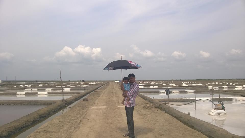
Salt manufactured.....india


 India’s position as the third largest salt manufacturer in the world.
Many companies have manufacturing units  and they procure salt in bulk quantities from the farmers for further purification and packaging.
Thoothukudi is the major salt producer in Tamil Nadu with Vedaranyam following close on its heels. Salt manufactured here is exported to a vast number of countries ranging from Qatar in the Middle East to Malaysia, Indonesia, Philippines and Vietnam in the Far East. Countries like China, Japan and Nepal also figure high in the export market.

“When the water is pumped into a collection pit, it will be around 100C,”

 The pumped up water is then run into square pans and is left to dry where it reaches 300C.


“It turns into salt in just about 3 hours on a sunny day
They periodically check the pans and sweep up the salt after the water crystallizes into salt.
The salt is then dried up in mounds before being filled up in sacks and taken away for processing.


The swept up salt, still dripping wet, is gathered in mounds and left for days to dehydrate.
To prevent the mounds from getting washed in an unlikely event of a rainfall, thatched palm leaves are spread forming a protective layer. The salt, thus stored, is inspected for its consistency after about 10 days and is prepared for loading. 


>>----THANKS FOR VISITING MY BLOG...KEEP IN TOUCH------>

Livestock.... cattle rearing india


Livestock plays an important role in Indian economy.
 About 20.5 million people depend upon livestock for their livelihood.

The livestock provides food and non-food items to the people.
  1. Food: The livestock provides food items such as Milk, Meat and Eggs for human consumption. 
  2. Fibre and skins: The livestock also contributes to the production of wool, hair, hides, and pelts. Leather is the most important product which has a very high export .
  3. Draft: Bullocks are the back bone of Indian agriculture. Despite lot of advancements in the use of mechanical power in Indian agricultural operations, the Indian farmer especially in rural areas still depend upon bullocks for various agricultural operations. 
  4. Dung and other animal waste materials: Dung and other animal wastes serve as very good farm yard manure . In addition it is also used as fuel (bio gas, dung cakes).
  5. Storage: Livestock are considered as “moving banks” because of their potentiality to dispose off during emergencies. They serve as capital and in cases of landless agricultural labourers many time it is the only capital resource they possess.
  6. Weed control: Livestock are also used as Biological control of brush, plants and weeds.
  7. Cultural: Livestock offer security to the owners and also add to their self esteem especially when they are owning prized animals such as pedigreed bulls, dogs and high yielding cows/ buffaloes etc.
  8. Sports / recreation: People also use the animals like cocks, rams, bulls etc for competition and sports.
  9. Companion animals: Dogs are known for their faithfulness and are being used as companions since time immemorial. When the nuclear families are increasing in number and the old parents are forced to lead solitary life the dogs, cats are providing the needed company
The livestock plays an important role in the economy of farmers.  The livestock serve the farmers in different ways.


  1. Income: Cows and buffaloes  in milk will provide regular income to the livestock farmers through sale of milk. Animals like sheep and goat serve as sources of income during emergencies to meet exigencies like marriages, treatment of sick persons, children education, repair of houses etc. The animals also serve as moving banks and assets which provide economic security to the owners.
  2. Employment: A large number of people in India being less literate and unskilled depend upon agriculture for their livelihoods.
  3. Food: The livestock products such as milk, meat and eggs are an important source of animal protein to the members of the livestock owners. 
  4. Social security: The animals offer social security to the owners in terms of their status in the society. Gifting of animals during marriages is a very common phenomenon in different parts of the country.  Animals are used for various socio religious functions. Cows for house warming ceremonies; rams, bucks and chicken for sacrifice during festive seasons;  
  5. Draft : The bullocks are the back bone of Indian agriculture. The farmers especially the marginal and small depend upon bullocks for ploughing, carting and transport of both inputs and outputs.
  6. Dung: In rural areas dung is used for several purposes which include fuel (dung cakes), fertilizer (farm yard manure)
         
>>----THANKS FOR VISITING MY BLOG...KEEP IN TOUCH------>

Mamallapuram, or Mahabalipuram.....land between the Bay of Bengal and the Great Salt Lake Tamil Nadu.


Mamallapuram, or Mahabalipuram, is a town on a strip of land between the Bay of Bengal and the Great Salt Lake, in the south Indian state of Tamil Nadu.
 It’s known for its temples and monuments built by the Pallava dynasty in the 7th and 8th centuries. The seafront Shore Temple comprises 3 ornate granite shrines.

                                          Bhima Ratha

 Krishna’s Butter Ball is a massive boulder balanced on a small hill near the Ganesha Ratha stone temple.
The history of Mahabalipuram is an intriguing one. Although its ancient history remains unclear, numismatics, temples and other sources of historical evidence suggest that it was a place of significance even before the temples were built. Some historical facts about Mahabalipuram are mentioned below:

       Arjuna's Penance                                                    Dharmaraja Ratha

  • Mahabalipuram is a historic city and a UNESCO World Heritage Site
  • It became a prominent center of art and literature between 3rd and 7th century .
  • Ancient mariners referred to Mahabalipuram as the “land of the Seven Pagodas”.
  • Several coins excavated from here reveal the existence of trade with Romans in ancient times.
Address: Mahabalipuram, Tamil Nadu 603104
Architectural style: Dravidian architecture
Date built: 700–728
>>----THANKS FOR VISITING MY BLOG...KEEP IN TOUCH------>

Saturday, 15 September 2018

Athirapally waterfall, a major tourist attraction thrissur kerala


Athirapally is the land of rivers and forests and great waterfalls!
The destination houses the  largest waterfall in Kerala, the Athirapally waterfall, a major tourist attraction.

This patch in Sholayar ranges so beautifully intertwined with lush green forest cover and sizzling silver cascades and located central to Cochin and River Nila(Bharathapuzha), is a treat for the eyes during the monsoon.


Just a short drive from Athirappilly to the Vazhachal falls, which is close to dense green forests that are home to many endangered and endemic species of flora and fauna.
There is another waterfall on the way from Athirappilly to Vazhachal Falls, in close proximity to the road, which is locally called "Charpa Falls". Athirappilly Falls is the largest waterfall in Kerala and is nicknamed "The Niagara of India".
Local communities along the Chalakudy river banded together to stop the construction of a hydroelectric dam upstream from Athirapally Waterfall. The proposed dam would have submerged more than 140 hectares of forest, dried up extensive riparian areas downstream and destroyed Athirapally Waterfall, one of several scenic waterfalls important to the local tourism industry.
The dam also would have destroyed the critical habitat of many important species, including the rare Cochin Forest Cane Turtle, the endangered Great Indian Hornbill, the Lion-Tailed Macaque and the Nilgiri Langur.
Athirappilly Map


River

The 145 kilometres  long Chalakudy River, originates in the Anamudi mountains of the Western Ghats  and flows through the Vazhachal Forest toward the Arabian Sea. The river initially runs smoothly but becomes more turbulent as it nears Athirapilly.
 At Athirappilly Falls, the water surges around big rocks and cascades down in three separate plumes. Below the falls, the river remains turbulent for about 1 kilometre (0.62 mi) until it reaches Kannamkuzhi.
Then it calms and flows smoothly until reaching the dam at Thumburmuzhi.

Address: Athirappilly Water Falls Rd, Pariyaram, Kerala 680724
Hours:
⋅Closes 5PM
Phone: 0480 276 9888

>>----THANKS FOR VISITING MY BLOG...KEEP IN TOUCH------>

Vizhinjam lighthouse .....near Kovalam beach , Kerala.

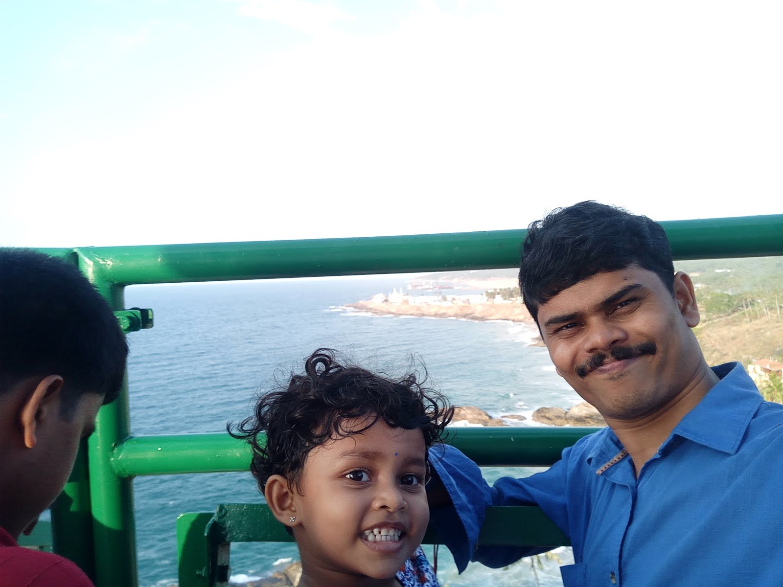
Vizhinjam lighthouse is situated near Kovalam beach in Kerala.
 It started functioning on 30 June 1972. Vizhinjam was a busy seaport in the eighteenth and nineteenth centuries.
                                                                                               on the top
The lighthouse is equipped with metal halide lamps and direct drive mechanism.
The light source was modified on 30 April 2003. 

    in lift inside light house
now it is one of the top tourist spot in trivandrum


Light house Junction, Near Kovalam, Vizhinjam Thiruvananthapuram Kovalam, Kerala 695521 India, Kovalam, Kerala
Height: 36 m
Opened: 1972
Hours:
Open ⋅ Closes 6PM
Tower shape: cylindrical tower with balcony and lantern with red and white color painting

>>----THANKS FOR VISITING MY BLOG...KEEP IN TOUCH------>

Friday, 14 September 2018

Kalvari Mount. The panoramic view idukki,,,kerala


One would marvel the nature’s ability to redesign itself to the human intervention at Kalvari Mount.
 This is the place where you will see the mighty Idukki dam and its reservoir from one of the highest points.

 The panoramic view from the top is simply exhilarating and refreshing.

Just 5 KM from Idukki town and in the Idukki Kattappana route, Kalvari mount serves both as a refreshing picnic spot and as a Christian pilgrim centre called Kurisumala.

 It also gives the view of Kamakshy and Mariyapuram, the most prominent tribal villages of the region.

Such big is the view of reservoir that it looks like periyar river itself from the highest point of and unless you know that this is actually formed after the implementation of the Idukki Hydroelectric project on 1975, you will not identify it.
 This simply shows us there is no better designer than the nature itself.
This reservoir, got created after the construction Idukki, Cheruthoni and Kulamavu dams which holds the water of the Periyar river and uses it for Hydroelectric power generation at the power plant in Moolamattam.
ticket counter and entrance
Better you set the journey before March as sunny days wont give you the exact misty experience in the valley. Don’t wait for the summer, make it on January or February or else plan after monsoon from September onwards.

Emerging Tourist Place,Kalvari MountKalvari mount was not known to many until recently. The Forest Department of the Government of Kerala has set up cottages which can be rented for day or day/night basis. This place is definitely a great place for nature lovers, trekkers, photographers and bikers.

Bikes and car can go near to the top point of Kalvari mount. Larger vehicles need to be parked in the Idukki kattapana road which is about about 1.5 KM downhill.
So if you are planning to go as a large group, better take some refreshments along with you as shops are not present on top as of now. Please make sure not to litter the area with plastics
.Always carry an umbrella as the chances of rainfall is high in hilly areas.

Reaching there

Idukki valley is 121 KM from Kottayam and 111 KM from Ernakulam.
Kalvari mount is situated in the Idukki Kattappana route.
Buses ply frequently in this route and taxis are also available from Kottayam or Ernakulam. Both Kottayam and Ernakulam has railway stations with Ernakulam being a larger one.

Address: Thodupuzha - Puliyanmala Road, Idukki, Kerala 685602
Hours:
Open 7AM⋅ Closes 6PM
Phone: 079028 36850


>>----THANKS FOR VISITING MY BLOG...KEEP IN TOUCH------>

vanchi....Vallam , Thoni,etc.....

  These are water transport vessel that carries different names in different regions.   The terms Vallam , Thoni,etc. are found in the early...